Horndean is a village and civil parish in the East Hampshire district of Hampshire. It is 8 miles (13Km) north of Portsmouth.
The 2 parishes forming most of Horndean, Blendworth and Catherington, can be dated to the early 12th century although the communities existed before that time.
The name of Horndean is found in records of 17th century although it certainly existed in the 16th century, which is when Portsmouth began to grow because of the naval development of the port. Horndean expanded due to its convenient position as a staging post on the road from London to Portsmouth. It was on the road at a junction which meant travellers could go via Havant if they wished to avoid the hazards of the long unbroken stretch through the forest of Bere.
The name Horndean most likely means “valley by a horn-shaped hill”. Dean refers to and old English word meaning valley, it can also mean forest. The village experienced significant expansion in the 20th century. The building of the A3(M) motorway in the 1970s and easy access to Horndean encouraged and influx of light industry to the village.
The village was probably best known as the home of Gales Brewery, which existed in the village from 1850 and was the largest local employer. It was privately owned until November 2005, when it was bought by Fullers. The Brewery, now closed, has been converted into flats.
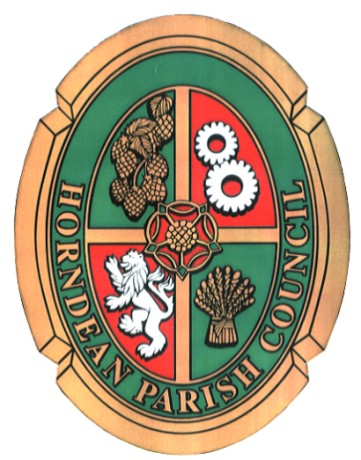
Coat of Arms
The Parish Coat of Arms is divided into 4 quarters; Cog Wheels representing local industry, Hops representing Brewing, a Sheaf of Corn representing farming and a Lion "Rampant" represent Simon de Montfort who owned all the land in the area after the Norman Conquest. The Rose in the middle is the Hampshire Rose, the emblem of the County.
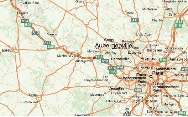
Aubergenville
Aubergenville is about 25 miles or 40km North West of Paris and about two hours by road from Le Havre. Its population is slightly less than Horndean but its size is about the same. Like Horndean it also straddles a Motorway!
The city is located at the meeting point of two valleys; to the west the Mauldre Valley and to the north the Seine Valley which still contains evidence of having been inhabited since prehistoric times. The settlement of the current town dates back to the 4th century BC and Aubergenvilloise agriculture is distinguished at this time by the size and importance of its vineyards.
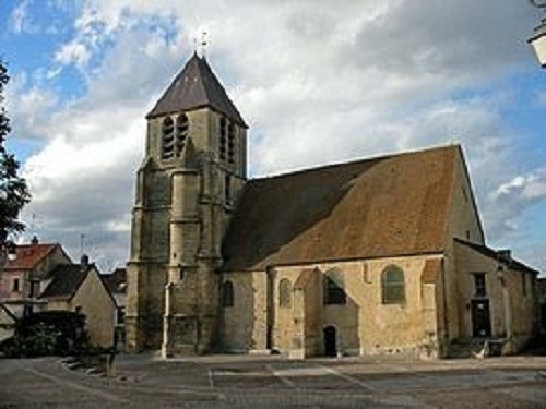
Built at the foot of hillsides, the old village is located around the church, in a concentric way. With its narrow streets, it is an intimate and closed atmosphere that emanates and gives it a village spirit.
On the other side of the A13 motorway is the district of Elizabethville (named after the Queen of the Belgians) which was built as part of Aubergenville between 1922 and 1928. It is built on the alluvial plain, near the station. It is a ‘Garden city’ located along streets radiating from the Place de l’Etoile and consists of a set of about 150 villas, a golf course and a casino.
The Renault factory complex and the park are also located within this area of Aubergenville.
Aubergenville Logo
A new logo was adopted by Aubergenville on 5th June 1990. It is part of an open circle signifying the radiation and the unity of the city.
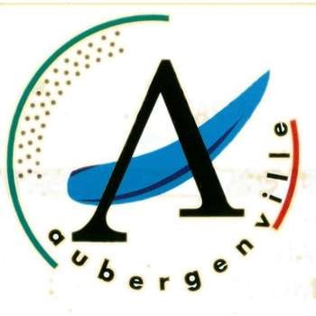
It is composed of in dissociable elements: the letter A (for Aubergenville) is at its centre: it is crossed by a line of blue brush representing the Seine; the last letters of the word “Aubergenville”, highlighted with red, are a reference to its urban character.
As for the left side of the logotype’s circumference, its green colour brings us back to the privileged environment and respect for the environment to which Aubergenville is attached. This green border is lined with a series of grey pixels that represent the importance of its industrial and tertiary activities.